Boarding for the French Riviera
Bordered by the Grande Bleue, the Côte d'Azur or French Riviera is the part of the French and Monegasque Mediterranean coast that extends to the West by the Commune of Cassis, and to the East by Menton (Italian border). It includes two departments, the Alpes Maritimes and the Var in their entirety and part of the Bouches du Rhône.
Bordered by the Grande Bleue, the Côte d'Azur or French Riviera is the part of the French and Monegasque Mediterranean coast that extends to the West by the Commune of Cassis, and to the East by Menton (Italian border). It includes two departments, the Alpes Maritimes and the Var in their entirety and part of the Bouches du Rhône.
Proposal of a one-week cruise from our base in Antibes
(direction l’Ouest)
ANTIBES Juan-les-Pins
Antipolis, the city across the street. Probably because it is located opposite Corsica, and because the Phocaeans used to use this sea route to reach the mainland (which still represents the shortest route for a crossing today). Antipolis was founded by the Phocaeans, Greeks from Asia Minor, and became a trading post in the 4th century BC.
J-C. Antibes has long played a military role in its history. You will thus have the opportunity to discover its ramparts and its "Fort Carré" built in the mid-16th century under Henri II by Henri-François de Mandon, who hosted several sports and military schools a few years ago. You can now visit it (contact the tourist office).
A seaside resort par excellence, the Juan-les-Pins district has become a major tourist attraction known for the warmth of its summer nights.

The anchorages
From our base located in the Port of Antibes (first European port in tonnage), you will have the opportunity to pass in front of the international quay, a refuge for exceptional units.
L’Anse de la Garoupe
Position 43°33,45’ Nord – 7° 08,3 Est
Sheltered by wind and sea from North to West (mistral)
Type of bottom: sand
L’Anse du faux argent
Position 43°32,7 Nord – 7°07,6 Est
Sheltered by wind and sea from North to West, open to the East
Type of bottom: gravel
You are in the heart of the Cap d'Antibes, a real green setting in the heart of the Côte d'Azur. If you step ashore, you will have the opportunity to admire luxurious properties (Villa Eilen Roc can be visited), or climb to the Lighthouse of the Garoupe by the Chemin du Calvaire...
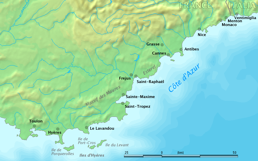
Les Iles de Lérins
Located to the south-east of the Croisette, these islands form an archipelago separating the Gulf of Napoule to the west from the Gulf of Juan to the east, and consist of two islands: Sainte Marguerite, the most extensive, famous for its fort which would have sheltered the man in the mask of the Iron Mask, and Saint Honorat, the smallest known for its Monastery. If you set foot on land, do not hesitate to discover the vineyard maintained by the Community for 1600 years.
Position 43°30,8’ Nord – 7° 08,3 Est
Ne permet des mouillages que par beau temps
Nature des fonds : sable et herbiers
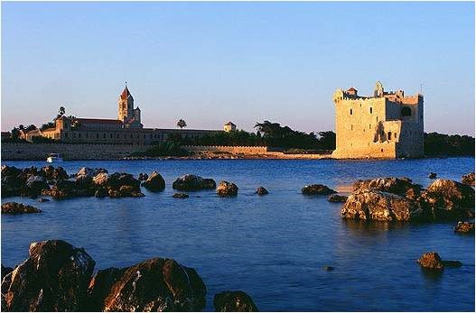
Théoule
Last step before entering the Var, the small Port of Théoule is worth it, if you have the chance to find a place there. You are at the foot of the Esterel Massif, recognizable by its sublime red rocks
Baie de la Figueirette
Position 13°29 Nord – 6°56 Est
Abrité par vent et mer de nord à ouest
Nature des fonds : sable et roches
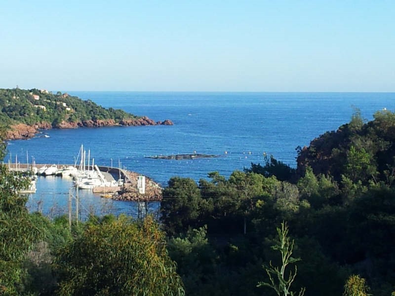
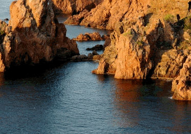
Le Massif de l’Esterel
It is the fruit of the earth's womb, this classified volcanic massif of 32,000 hectares was created 250 million years ago. Legend has it that a fairy, Estérelle, gave it her name. Women came to her for fertility counselling. First attached to Africa, this piece of land separated from it during the formation of the Mediterranean. In the tertiary era, a part of the Esterel went to drift... Corsica
La Rade d’Agay
Position 43°25,9 Nord – 6°51,6 Est
Nature des fonds : sable et herbiers
Abritée des vents d’Est et d’Ouest
Port le plus proche : Saint Raphael
Since 2004, the City of Saint Raphaël has set up organised anchorage areas to protect the seabed from wild fairground anchorage likely to damage Posidonia meadows and encourage the proliferation of CAULERPA TAXIFOLIA. One hundred and twenty-three boats up to 16 metres can be accommodated