LE GOLFE DE SAINT TROPEZ et ses abords
Saint Tropez
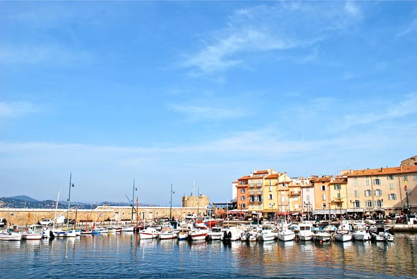
The place to be...but did you know that before becoming the resort of the people, Saint Tropez is first and foremost a fishing village at the beginning of the 20th century. Guy de Maupassant came to rest there in 1887, he was then suffering from syphilis.
It was in the 1950s that Saint Tropez became Saint Tropical. We met Sagan, Picasso, Prévert. The myth was accentuated with the arrival of Brigitte BARDOT in the 1960s. Since then, the nights in Saint Tropez have not lost any of their beautiful reputation
L'Anse des Canebiers (ou Anse des Canoubiers)
Position 43°16,3 Nord – 6°39,7 Est
Abritée des vents et mer de secteur Est, ouvert au Mistral
Located at the entrance to the Gulf, before arriving in Saint Tropez. It is the ideal place if you want to spend a night in the calm of Tropezian fever, if the weather conditions allow it.
Port Grimaud
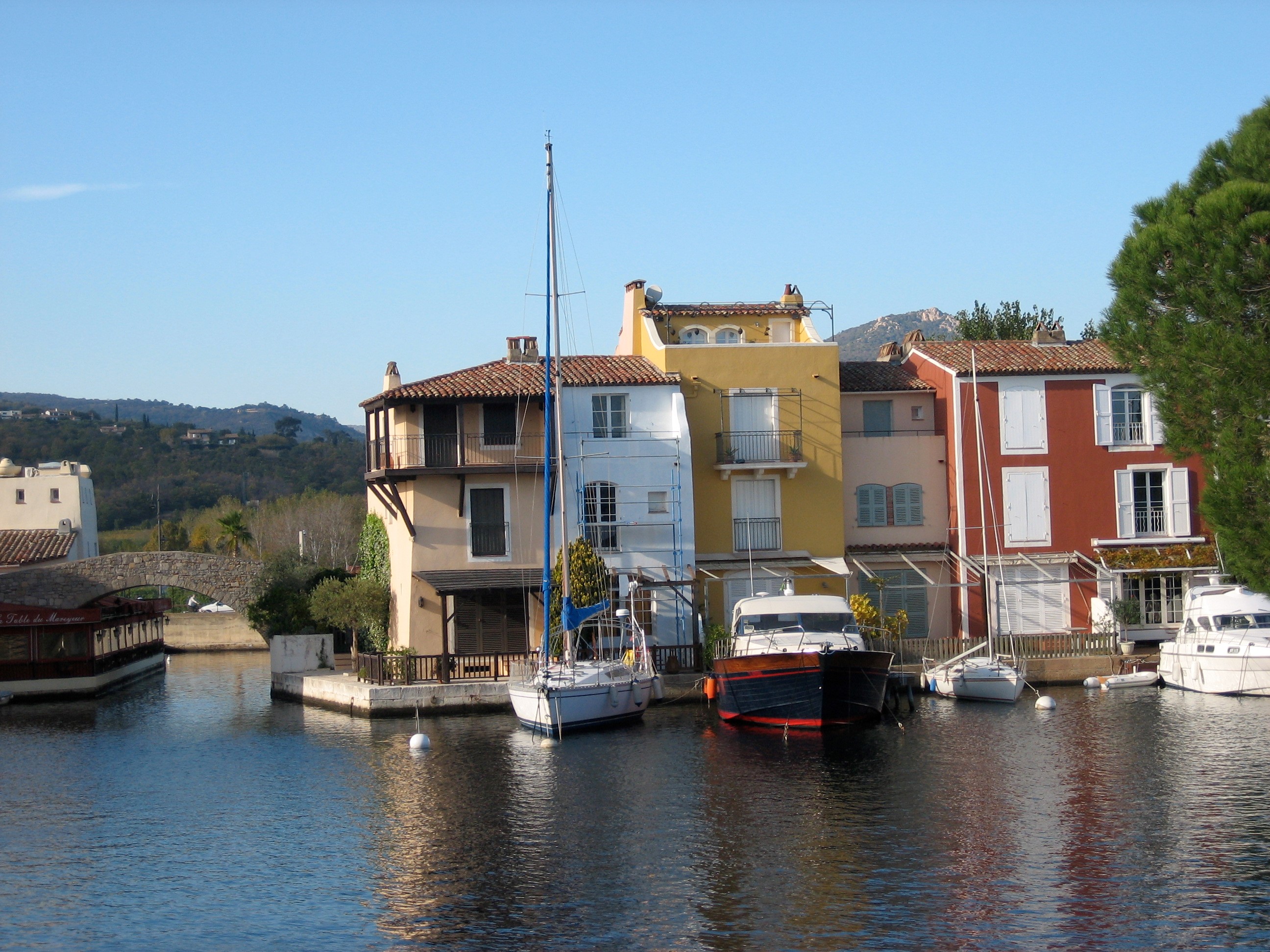
Designed in 1966 by architect François SPOERRY, the Cité lacustre is located at the bottom of the Gulf of Saint Tropez. Originally it was only a marshy area infected with mosquitoes that was for sale, yet François SPOERRY knew that he had just discovered the land of his dreams... And that is how this small Provençal village was born, from which each house is served by a dock, on one of which you can undoubtedly moor. In September 2002, Port Grimaud was listed as a 20th century heritage site.
Translated with www.DeepL.com/Translator
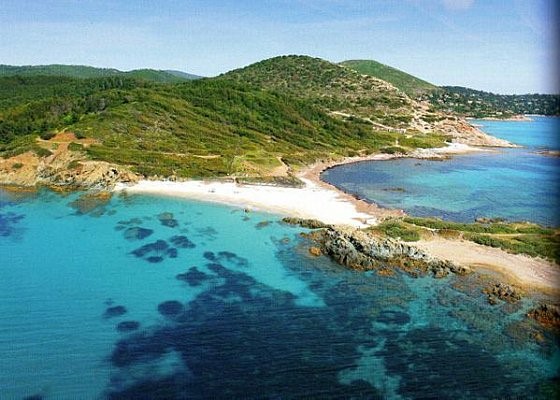
La Baie de Pampelonne
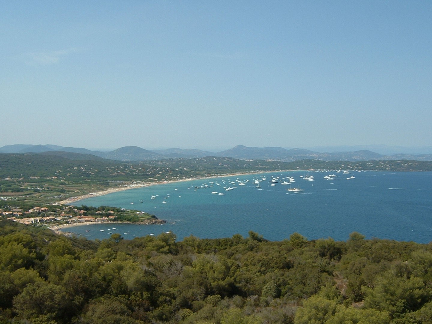
Position : 43°13,5 Nord – 6°40 Est
Abritée par vent du Nord à l’Ouest. Attention aux vents d’Est.
Nature des fonds : sable
The beach of Pampelonne is part of the Tropezian myth. Roger VADIM will shoot there within 50 "and God created the woman" with Brigitte BARDOT. 4.5 km long, Papelonne beach is bounded to the south by CAP CAMARAT and CAP BONNE TERRASSE, to the north by CAP PINET. You will meet prestigious yachts from the four corners of the coast and enjoy the restaurants located on the many private beaches
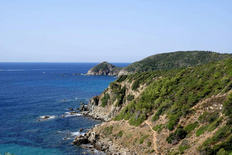
LES TROIS CAPS DE LA PRESQU’ILE DE SAINT TROPEZ : Cap Camarat, Cap Lardier, Cap Taillat
These three headlands are protected by the Conservatoire du Littoral because of the richness of the fauna and flora that reside there.
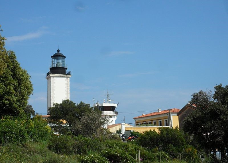
Cap Camarat : is located south of Saint Tropez. Its lighthouse, commissioned in 1831, is one of the highest in France, reaching a height of 129.80m and has a luminous range of 60km.
Cap Taillat : very steep Cap Taillat is connected to the coast by a fragile sand isthmus. It is part of the three capes of the peninsula of Saint Tropez which covers an area of 1272 hectares for the land part and 750 hectares for the sea part, and on the coastal path there is at its extreme point the customs house, built under Napoéon 1st this building sheltered the soldiers in charge of maintaining the continental blockade against England.
Cap Lardier :of the three capes, it is the one that advances the most into the sea, it closes Cavalaire Bay to the east. Its steep cliffs fall directly into the sea and prevent its access.
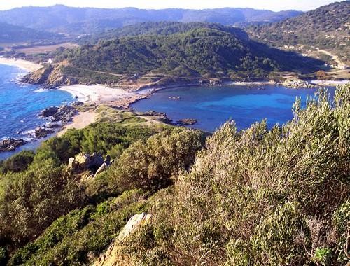
Baie de Briande
Located between Cap Taillat and Cap Lardier, the bay is known for its fine sandy beach, a mecca for the hippie movement in the past, it has kept its wild appearance.
Position : 43°10,3 Nord – 6°38,4 Est
Abritée des vents du Nord et de l’Ouest
La Baie de Cavalaire
Located between Saint-Tropez and Le Lavandou, and at the foot of the first slopes of the Massif des Maures, Cavalaire Bay shelters a pretty little port, particularly welcoming with its restaurants.
Position 43°09 Nord – 6°26,2 Est
Abritée des vents et mer de Nord
Du cap benat au fort bregancon
Le Cap Bénat et la Grande Calanque
Cap Bénat is a small rocky point located in the commune of Bormes-les-Mimosas and facing the islands of Hyères. Largely covered with pine trees, it houses residential houses and a semaphore of the French Navy. Fort Brégançon is located on the western edge of the cape.
Position : 43°05,4 Nord – 6°221 Est
Abrité par vent de Secteur Nord
Nearest ports Miramar in the West, Bormes les Mimosas (6M) in the East (2.5M)
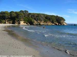
Pointe de la Galère, plage de la Reine Jeanne
The port of Queen Jeanne will not be able to accommodate you with its funds below 1M50. So prefer the beach to wet it.
Position du port : 43°05,5 Nord – 6°05,9 Est
Abrité par vent et mer d’Est
Fonds en sable (2-4m)

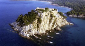
Fort de Brégancon
Assigned to the Ministry of Cultural Affairs since 1968, the Fort of Brégancon serves as a State residence placed at the disposal of the President of the Republic. It is located in the Commune of Bormes les Mimosas, on a 35m high rocky peak. For obvious security reasons, the site is highly secure, navigation and anchorages are prohibited in summer.
LES ILES D’HYERES, parc naturel national
Les iles de Porquerolles
Porquerolles successively became the property of Monsieur de Roussen in 1881 and then of a land company in 1905. The land company on the island of Porquerolles did major work: power plant, water retention basins. Poorly managed, it quickly ran out of shareholders' funds and in 1912 Porquerolles was sold for 1,000,100 francs to François Joseph Fournier. Fournier, son of a poor Belgian boatman, had ended up making a fortune in gold exploration in Mexico, after years of a rather extraordinary adventurous life passing through Canada, Panama and California. From the time he settled in Porquerolles until his death in 1935, Fournier set about developing a philanthropic farm. In 1971, the State entrusted Port-Cros National Park with the management and development of the 1000 hectares of the former Domaine Fournier, which it had just acquired on the island of Porquerolles. In 1985, the Park became the owner of this area, which represents 80% of the island, through a grant from the State.